Land infrastructure for Africa.
QwikPlot is one platform to sell, manage and verify land. A developer's whole estate goes onto a living map, and from there the sale, the money and every document run through a single record that the buyer and the agent read the same way.
Every parcel sits on its real surveyed boundary. A buyer picks the exact piece of land they want and pays through the same system that holds the title trail, so the parcel is locked to them the moment they do. No parcel is ever sold twice, and nobody has to take your word for it.
The difference between selling land and being trusted with it.
When the same parcel can be sold to two buyers, or a receipt cannot be found, or nobody can say for certain what was agreed, the whole development carries a risk that no serious buyer can overlook, and that is much of the reason land is so hard to sell at any real scale here. QwikPlot is built to take that risk out of the process. The map, the inventory, the payments and the documents all live in one record that the buyer and the agent read the same way, so an estate becomes something a buyer can check rather than something they are asked to believe.
Note · across this site we say parcel. On the ground in Zimbabwe it is known as a stand. Same piece of land, same record, and you will see "stand" in the live app below.
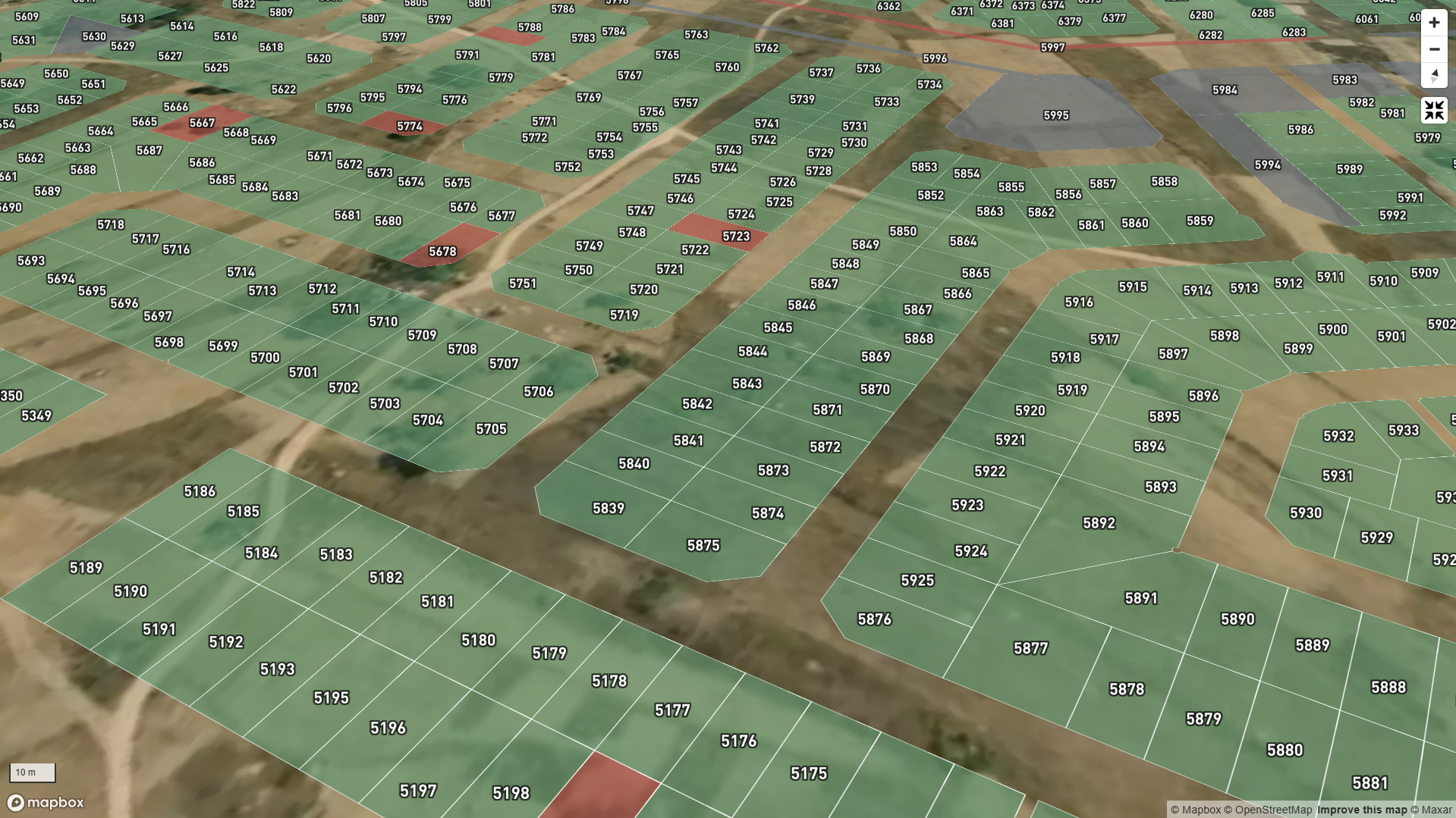
Walk the estate from above, parcel by parcel.
The estate opens as a real satellite map, every parcel drawn on its true boundary and coloured by what it is doing right now. A buyer taps the one they want and reads its size, its price and its status before anyone picks up a pen.
From a tap to a title, in one record.
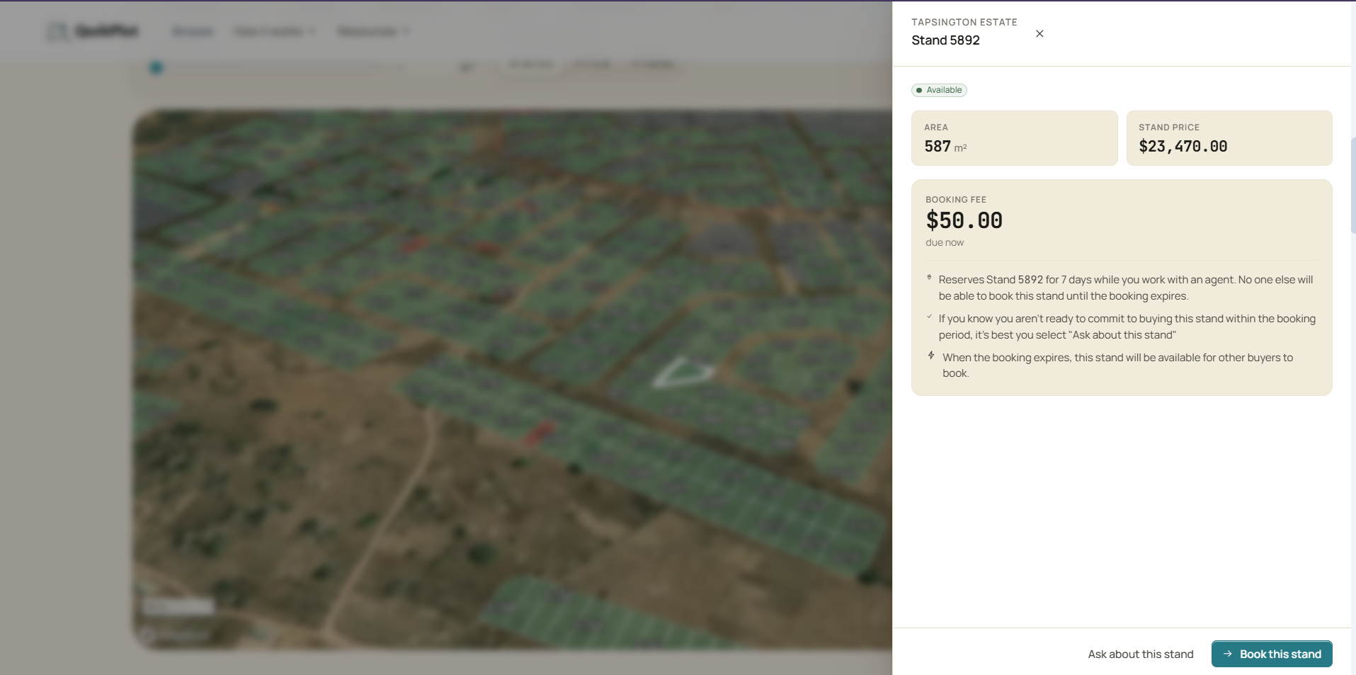
A buyer picks a parcel and the whole sale runs in the open: secure it with a booking fee, choose the agent who carries it, pay through Stripe or Paynow. The instant the fee clears, the parcel is theirs alone.
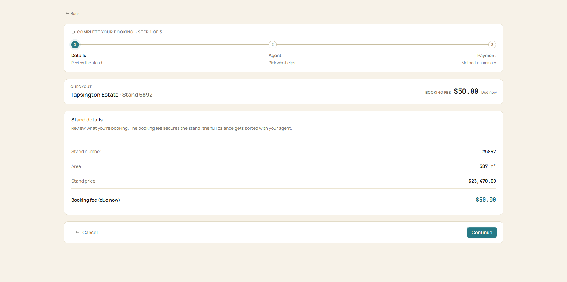
Pick it, see the terms, choose your agent. Parcel number, area, price and the booking fee due now, with the agent who will carry it, before anyone signs.
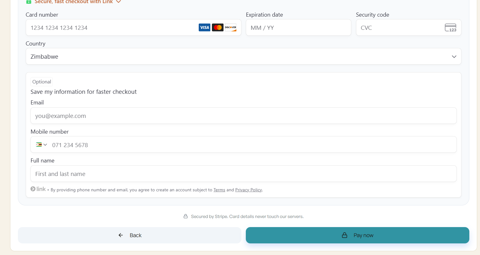
Stripe or Paynow. Mobile money for Zimbabwe, cards for the diaspora. Card details never touch our servers.
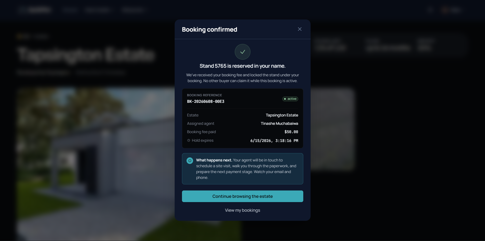
And then it locks.
"Stand 5765 is reserved in your name. No other buyer can claim it while this booking is active."
The moment the fee clears, the parcel leaves everyone else's map and belongs to a single record that updates live. The agent in the field and the developer in the office are looking at the same status at the same time, which is what makes it impossible for the same parcel to be sold twice.
Every part of your estate, in your hands.
Setting up an estate happens in one place, and it puts the whole thing in your hands. From a single settings desk you decide how the estate looks, what it costs to buy into, how inventory is released and who is allowed to sell it.
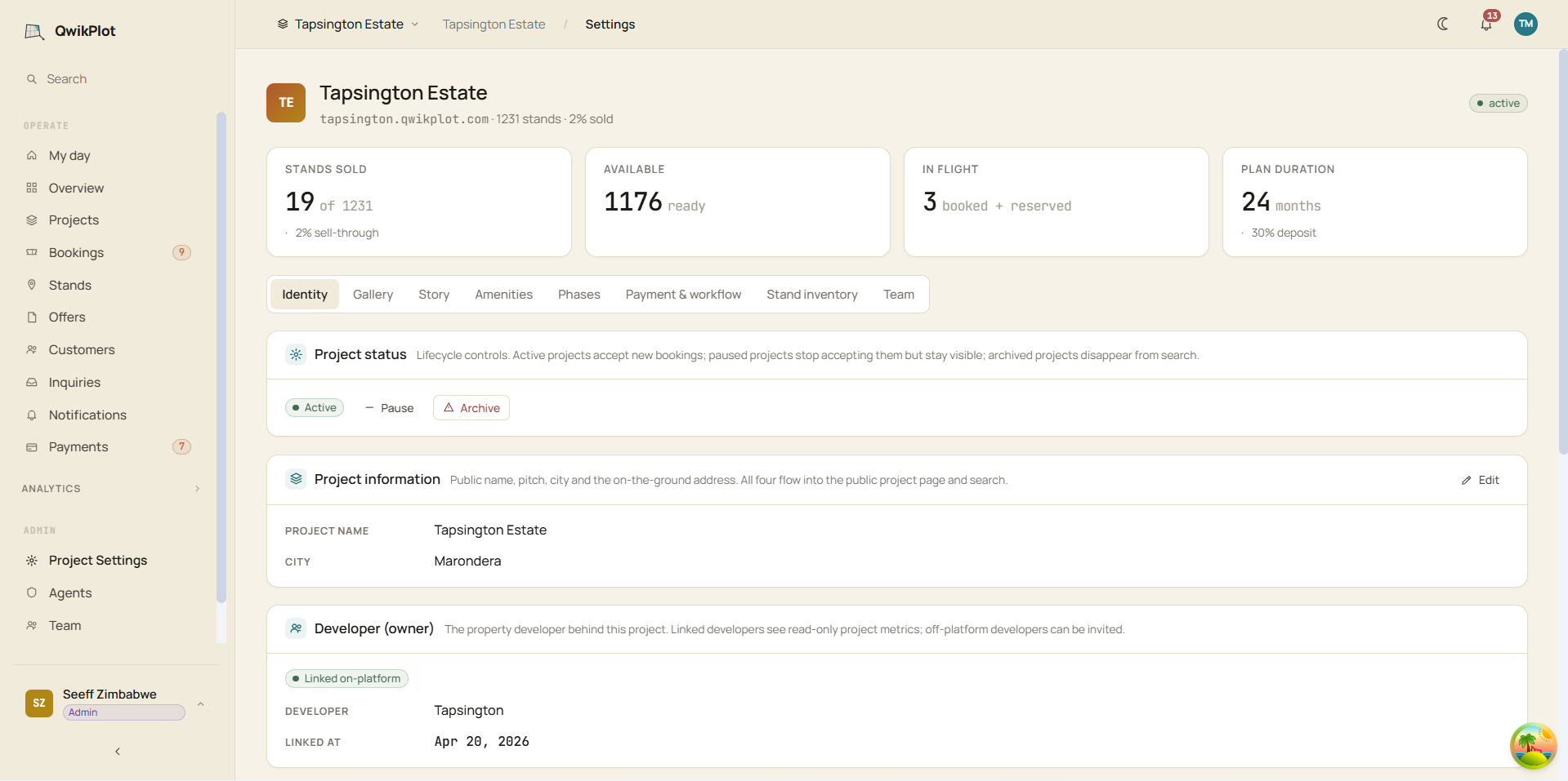
Owner, operator and how it shows.
- Public name, pitch, city and the on-the-ground address.
- Link the developer who owns the land; off-platform developers can be invited.
- Lifecycle in your hands: active, paused or archived.
- Branding: logo and accent colours on the public page and every PDF.
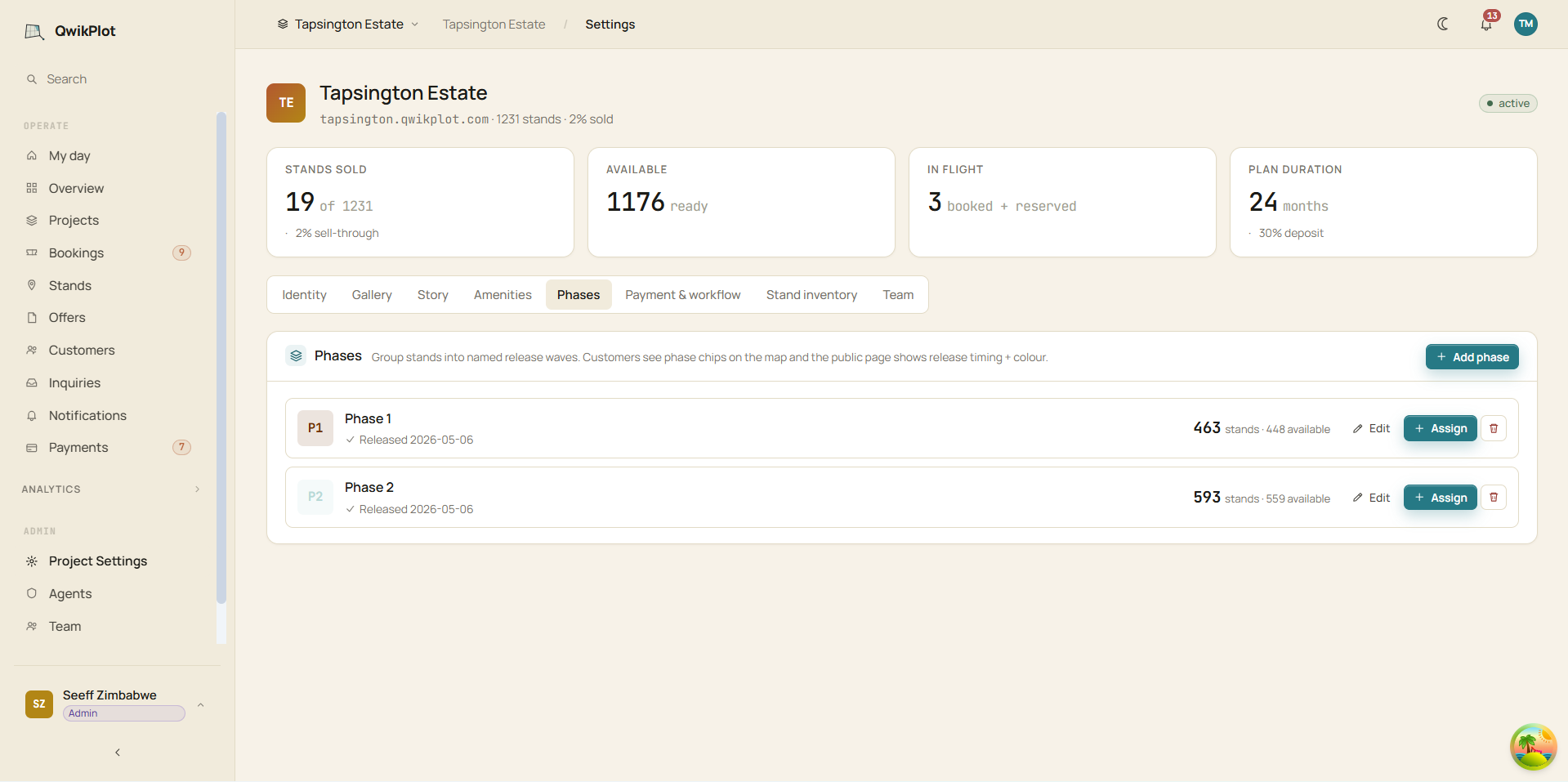
Sell in waves, on your timing.
- Group parcels into named release phases.
- Hold inventory back until you are ready to open it.
- Buyers see the phase and its release timing on the public page.
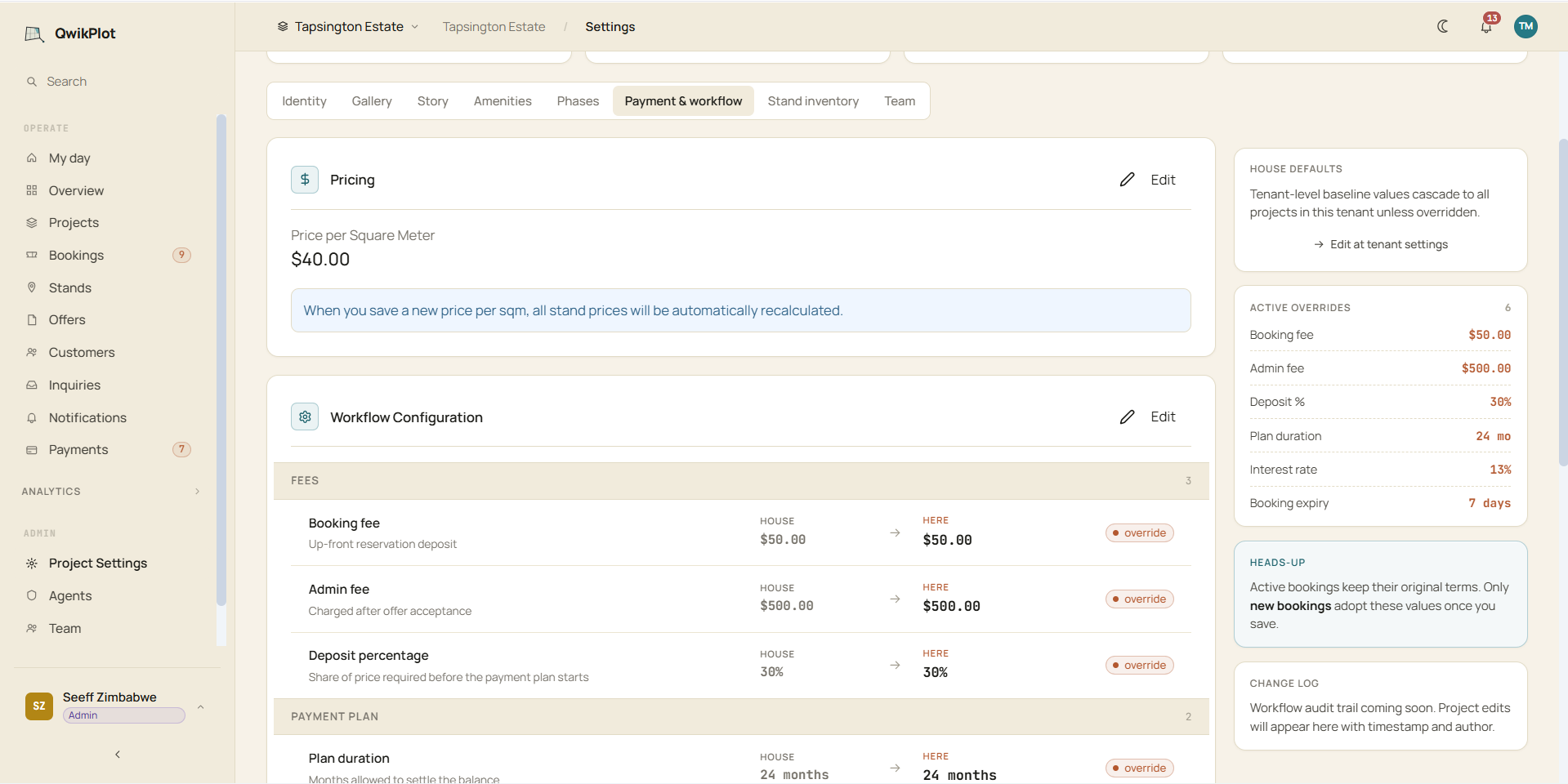
Set the cost of entry.
- Booking fee, admin fee and the deposit percentage.
- Per-square-metre pricing that recalculates the whole estate.
- Tenant defaults cascade to every project; any project can override.
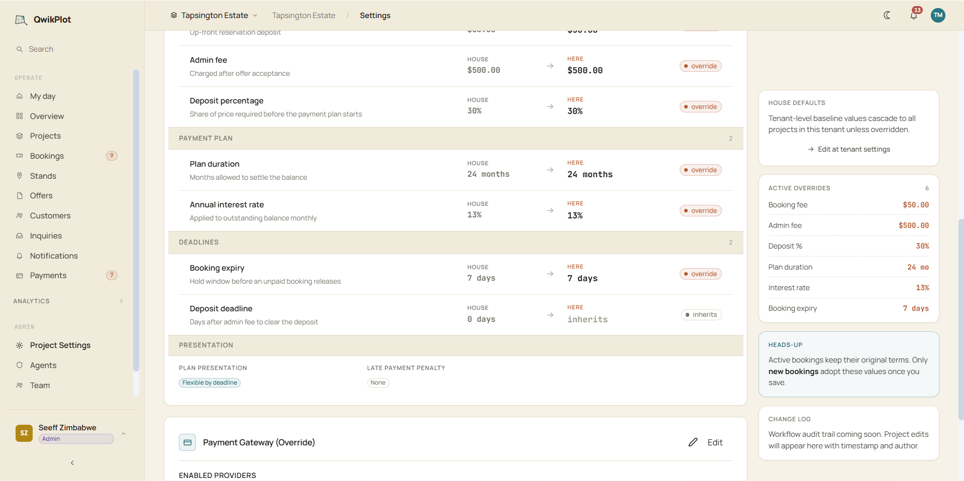
Shape the payment plan.
- Plan duration and the annual interest rate.
- Flexible-by-deadline, or a fixed monthly amount.
- Booking and deposit deadlines, and a late-payment penalty if you want one.
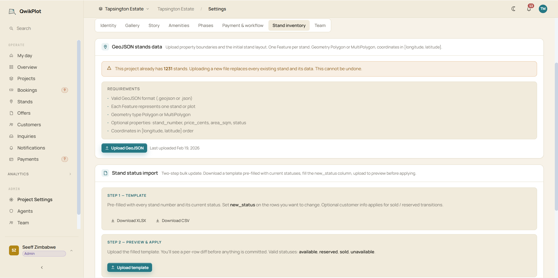
Load the whole estate at once.
- Import parcels by GeoJSON or CSV, drawn on their true boundaries.
- Set and bulk-update statuses: available, reserved, sold, off market.
- One source of truth the map and the office both read.
Eleven tabs, one estate. Identity, story, gallery and amenities for how it shows; phases, fees, deposit, payment plans, interest and deadlines for how it sells; inventory and team for what and who. Tenant defaults cascade to every project, and any project can override them.
Reservation to title, in one trail.
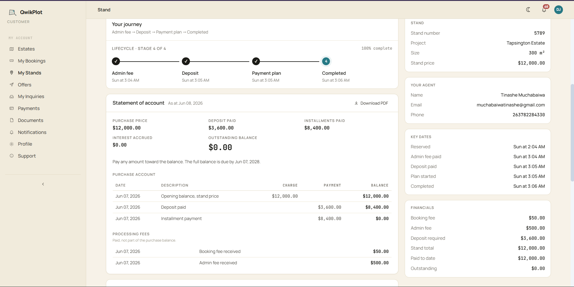
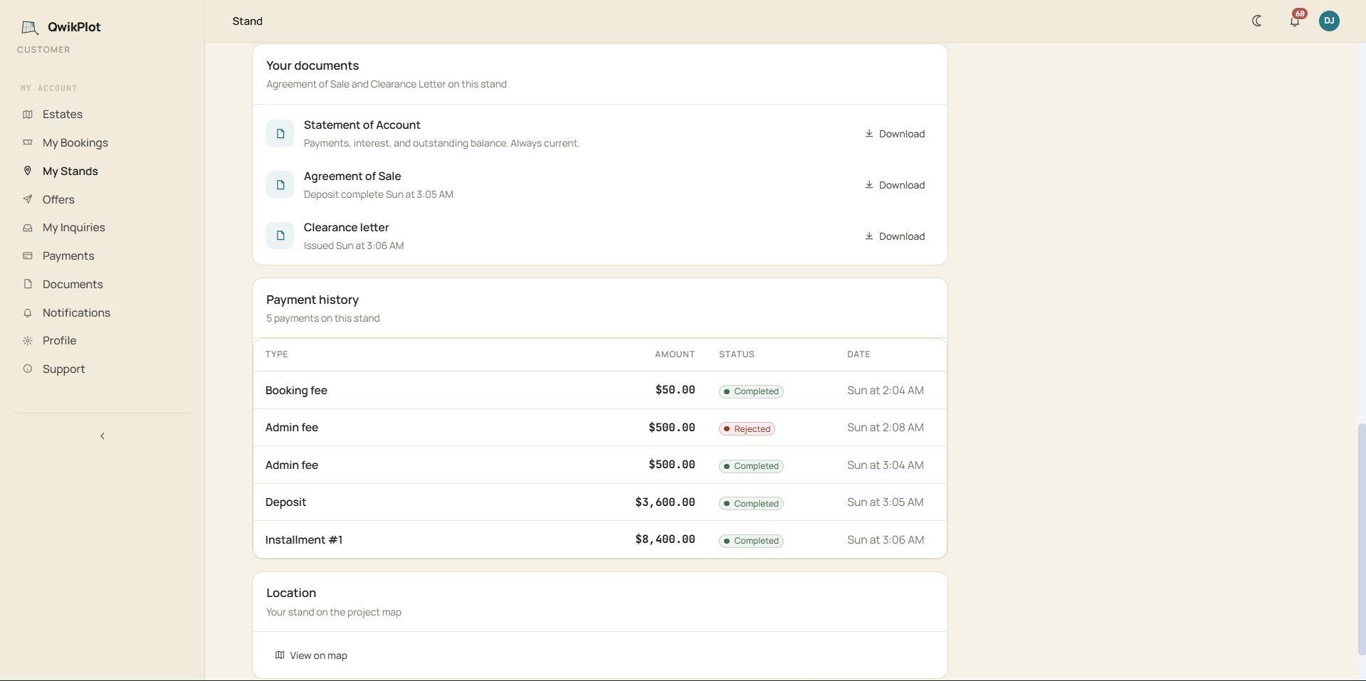
As a sale moves forward, each document is created where the sale happens, so a buyer always sees where they stand and what comes next, rather than hunting through messages and drawers for a receipt that may not exist.
Conveyancing, on the platform.
A layer where your conveyancers carry out the transfer work on top of QwikPlot, while the buyer follows every step toward title from the same record they have used all along. The lawyers work from one clean file, and the buyer is never left waiting in the dark for a deed.
The paperwork problem, solved.
Every document a land sale needs is written by the platform, at the moment it is supposed to exist. You decide when the Agreement of Sale is generated, whether that is at booking, at deposit or at a stage you set yourself, and QwikPlot draws it from the live record and hands it to the buyer. The clearance letter issues the instant the final payment clears, and receipts and statements keep themselves up to date. Nothing is printed, scanned or emailed back and forth, and there is never a copy that says one thing while your records say another.
The satellites are the input. The transactions are the labels.
Because every parcel on QwikPlot carries real coordinates, we can point earth-observation archives straight at it. Argus draws on open imagery from Sentinel and NASA Landsat that reaches back about fifteen years and refreshes every few days, and reads it as a record of what the land is and how it has changed. This is where the product is heading, and it is honest to say it is being built rather than already shipping.
A moat that cannot be assembled from the outside.
Anyone can buy the same imagery we can. What no one else has is the record of how land actually trades, because that record only exists where the deals happen. As parcels across the continent move through QwikPlot, every booking, cancellation and transfer teaches Argus how land really behaves, and the dataset compounds with each sale. In time that intelligence becomes the reference on land that banks, insurers and developers pay to draw on.
Built first for the people who sell land.
Run the whole development on QwikPlot.
The map, the inventory, the payments and the documents in one place, so your team works in the same system every day instead of stitching together spreadsheets and message threads. This is who we build for first.
Onboard your companyChoose the exact parcel, and trust the trail.
Pick your piece of land on a real satellite map, see precisely what it covers, and follow one record from reservation to title that you can actually check, rather than take on someone's word.
Browse a live estate →The platform proves it. Argus scales it.
The sales platform is live and earning today, the conveyancing engine is where the real commercial weight sits, and Argus turns every deal into a continental dataset that cannot be assembled from the outside.
Put your land on a map buyers can trust.
If you are selling land, we should talk. Tell us about your estate and we will survey it onto QwikPlot parcel by parcel, then you can watch it sell without a single double allocation and without anyone wondering whether the record is real.